

Profile
Kansas Drone Services
Kansas Drone Services operates as a professional aerial imaging and drone data provider based in Manhattan, Kansas. The company delivers drone photography, aerial mapping, and inspection services for commercial, agricultural, and industrial clients. By combining advanced drone technology with experienced pilots, Kansas Drone Services helps organizations gather accurate aerial data and compelling visual imagery.
The company focuses on practical drone applications that support real-world projects. Businesses often require aerial views to evaluate property conditions, track construction progress, or promote facilities. Kansas Drone Services provides these perspectives through carefully planned drone flights and professional imaging equipment.
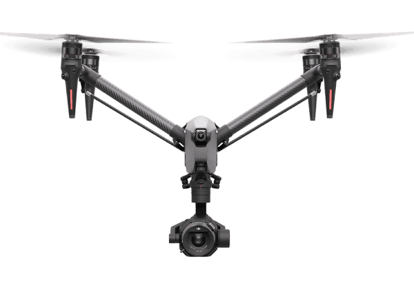
The team operates under FAA Part 107 certification and follows strict safety guidelines for commercial drone operations. Licensed pilots plan each mission carefully to ensure safe flight paths and reliable results. This attention to safety allows the company to work around construction sites, farmland, infrastructure, and commercial facilities.
Kansas Drone Services serves clients across Kansas and surrounding states. Its flexible service model allows the company to support both local projects and regional aerial imaging assignments.
Aerial Photography and Video Production
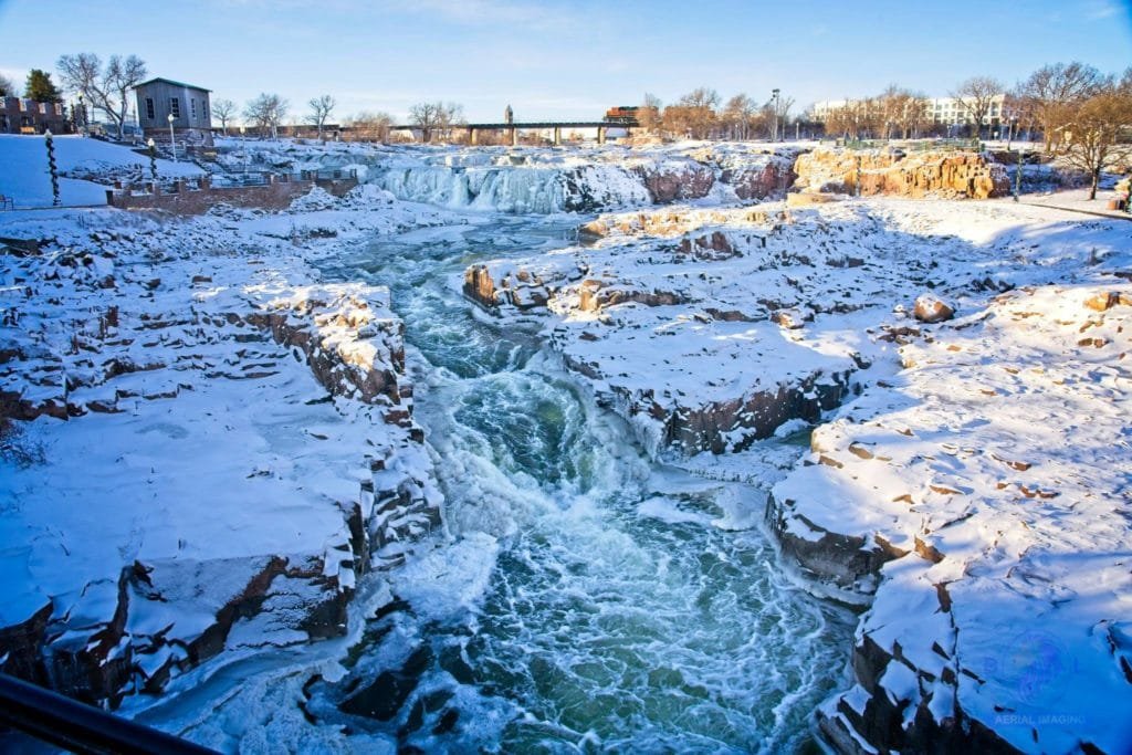
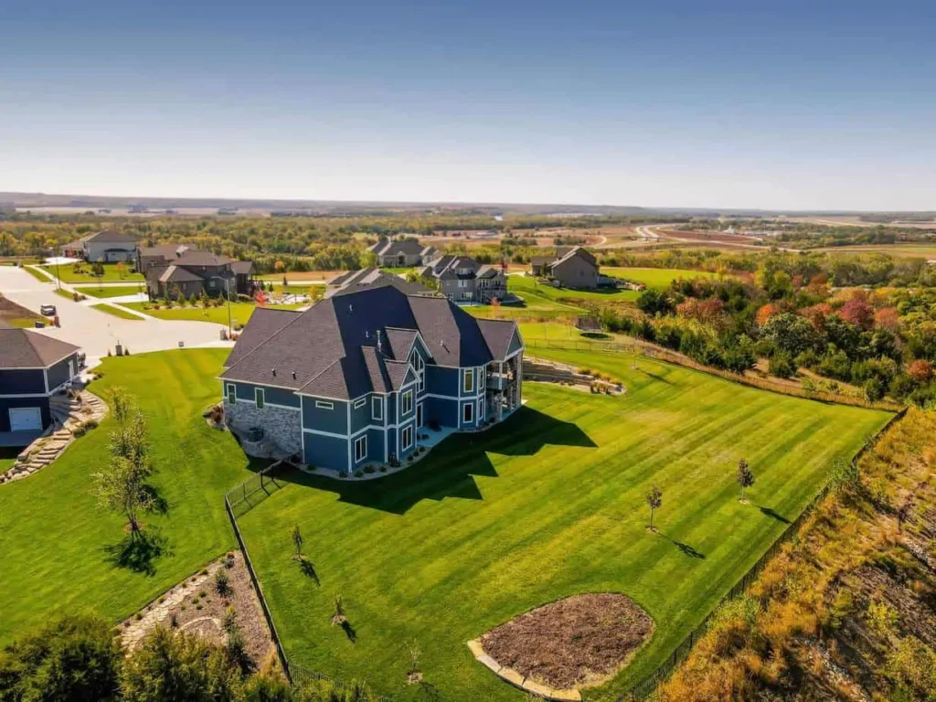
Kansas Drone Services provides professional aerial photography and drone video for businesses and property owners. High-resolution images reveal landscapes, infrastructure, and buildings from unique aerial perspectives. These visuals often help organizations present projects clearly to clients and stakeholders.
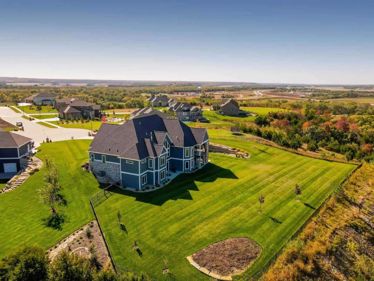
Real estate professionals frequently rely on drone imagery to showcase residential and commercial properties. Aerial photos highlight property boundaries, surrounding neighborhoods, and nearby amenities. These details help potential buyers understand the full context of a property before visiting.
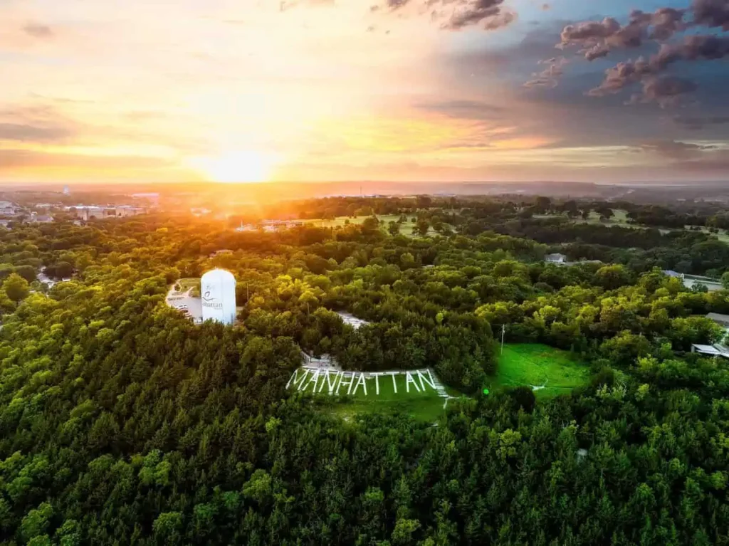
The company also produces aerial video footage for marketing and promotional projects. Businesses can use drone video to highlight company facilities, tourism destinations, and outdoor venues. Smooth aerial footage often enhances marketing campaigns and social media content.
Drone footage also supports community development and tourism promotion projects. Cities and organizations often use aerial visuals to showcase local attractions and landscapes.
Mapping, Inspections, and Agricultural Applications
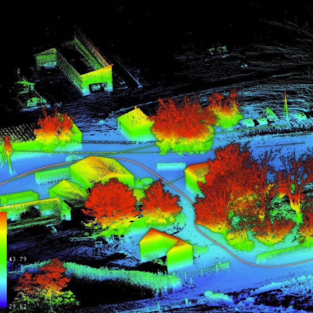
Kansas Drone Services also provides aerial mapping and inspection services. Drone mapping technology captures detailed images that combine into accurate orthomosaic maps. These maps help engineers, planners, and developers evaluate land conditions and infrastructure layouts.
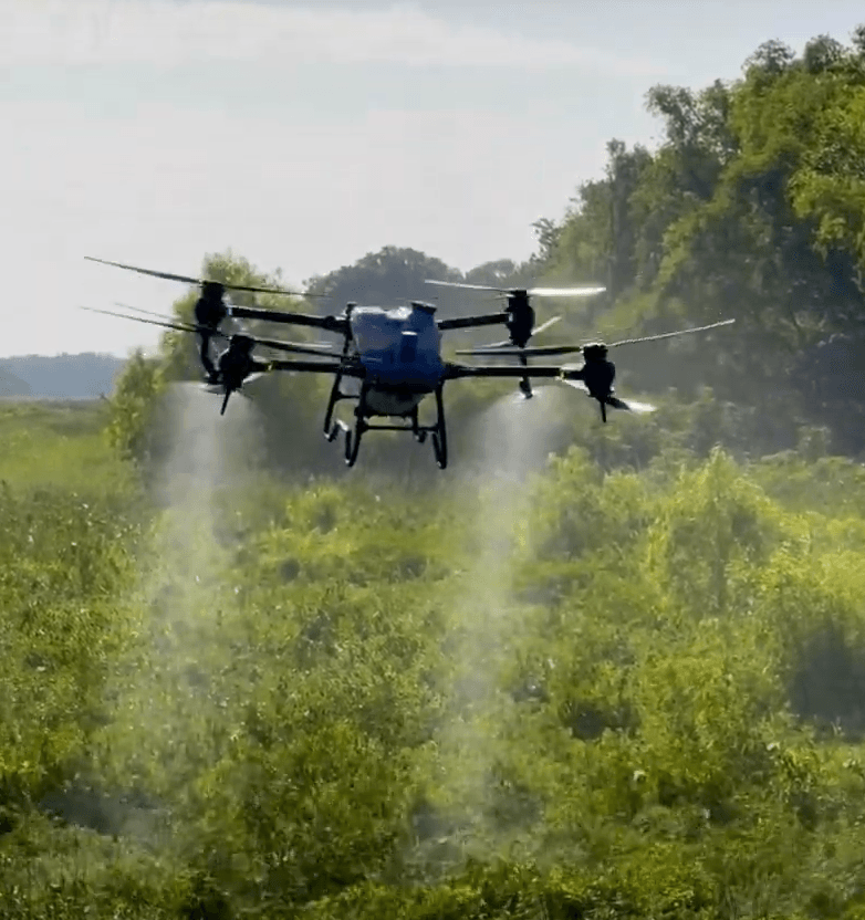
Agricultural operators often use drone imagery to monitor crop health and irrigation systems. Aerial views allow farmers to identify problem areas across large fields. These insights support better crop management and more efficient use of resources.
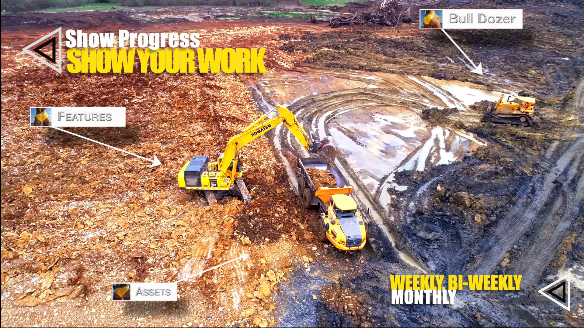
The company also performs aerial inspections for buildings, towers, and industrial facilities. Drone inspections allow operators to review hard-to-reach areas without climbing structures or using expensive equipment. This approach improves safety and reduces inspection costs.
Construction teams also use drone imagery to document project progress. Regular aerial updates create a visual timeline that shows how a project develops over time.
A Trusted Drone Service Provider in Kansas
Kansas Drone Services continues to support businesses, farmers, and developers across the Manhattan region. The company focuses on delivering reliable aerial data that helps organizations make informed decisions.
Clients appreciate the company’s strong communication and professional flight operations. Each project receives careful planning so the final imagery supports the client’s objectives.
Individuals interested in updates and aerial photography examples can visit the company’s
Facebook page, where recent projects and drone imagery are regularly shared.
Through modern drone technology and skilled flight operations, Kansas Drone Services helps organizations capture valuable views from above. The company continues to provide aerial photography, mapping, and inspection services that support industries across Kansas.

Map
Sorry, no records were found. Please adjust your search criteria and try again.
Sorry, unable to load the Maps API.