

Profile
Aerial Imaging Services of Maine: Professional Drone Services for Real Estate, Construction, and Inspections
A Trusted Drone Service Provider in Richmond, Maine
Aerial Imaging Services of Maine operates as a professional drone services company based in Richmond, Maine. The company began operations in 2016 and focuses on providing reliable aerial photography, video, and drone data solutions for businesses across the region.
The company serves clients throughout Central and Southern Maine. Businesses in areas such as Waterville, Brunswick, and Auburn rely on the company for accurate aerial imagery and dependable service.
Aerial Imaging Services of Maine supports industries that require precise visual documentation. Real estate professionals, construction companies, and infrastructure managers depend on aerial data to improve project oversight. The company provides high-resolution photos, video, and mapping data that help clients understand their projects from a better perspective.
The business operates as a fully insured and FAA-certified drone service provider. The team uses modern drone technology to capture accurate images and detailed aerial information. These tools allow clients to track projects, improve planning, and reduce operational risks.
Aerial Imaging Services of Maine also focuses on strong customer communication. The company works closely with each client to understand project goals and develop a practical flight plan. This hands-on approach helps ensure every project receives the attention it deserves.
Drone Photography and Video for Real Estate Marketing
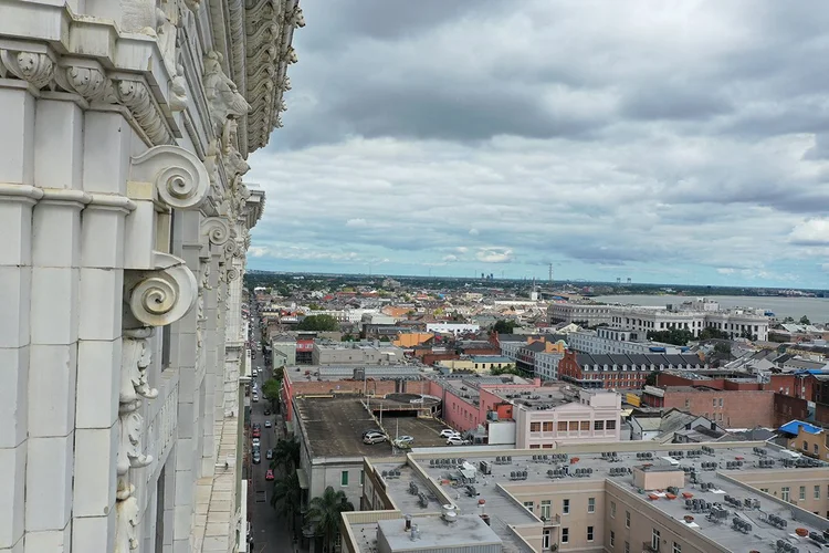
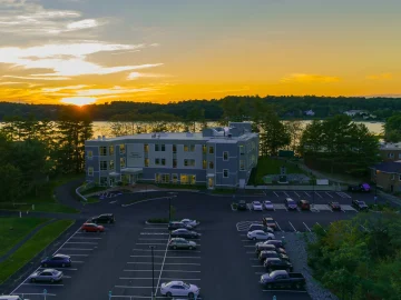
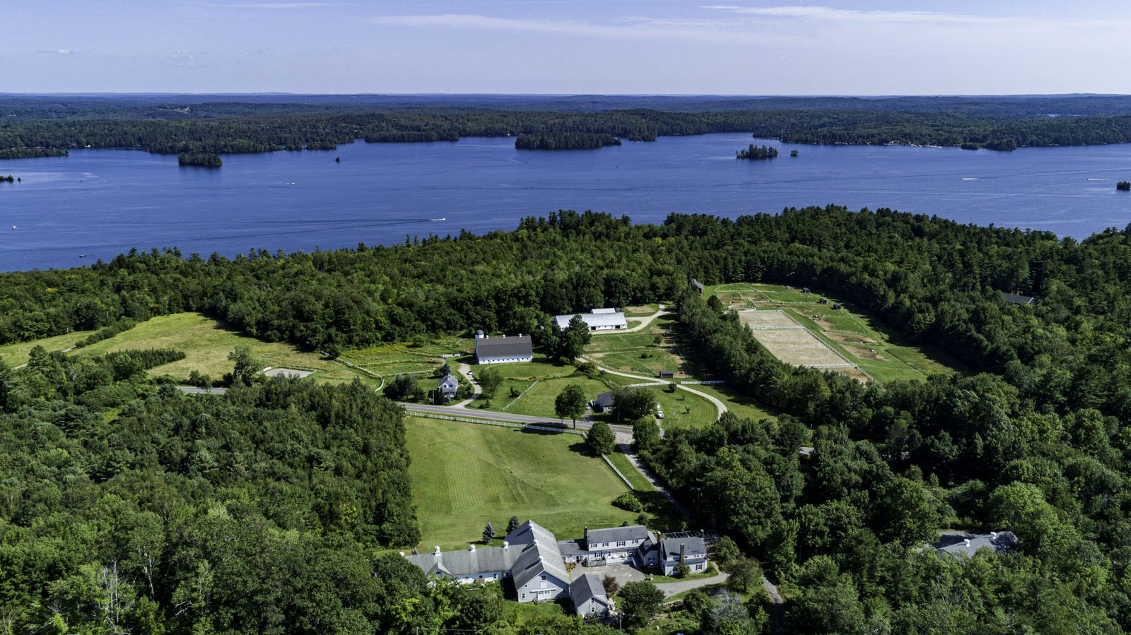
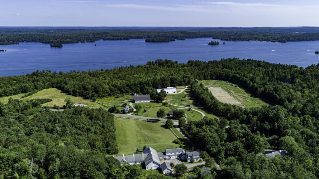
Real estate photography represents one of the most popular services offered by Aerial Imaging Services of Maine. Drone photography allows real estate professionals to present properties from unique and engaging perspectives.
High-resolution aerial images reveal property layouts, surrounding landscapes, and neighborhood features. These visuals help potential buyers understand the full value of a listing. Drone photography often attracts stronger online engagement and helps listings stand out in competitive markets.
The company also produces aerial video content designed for property marketing. Video tours provide a cinematic overview of homes, land, and commercial properties. Agents often use these videos on listing platforms and social media campaigns.
Each photo session includes careful planning and setup to capture the best lighting and angles. This attention to detail helps deliver professional results that highlight each property effectively.
Construction Monitoring and Drone Inspection Services
Aerial Imaging Services of Maine also supports construction companies with drone-based monitoring and mapping services. Drone imagery allows project managers to track construction progress quickly and accurately.
Regular aerial updates provide clear visual records of job site development. Stakeholders can review photos, maps, and models from any location. This information helps project teams monitor timelines and improve communication.
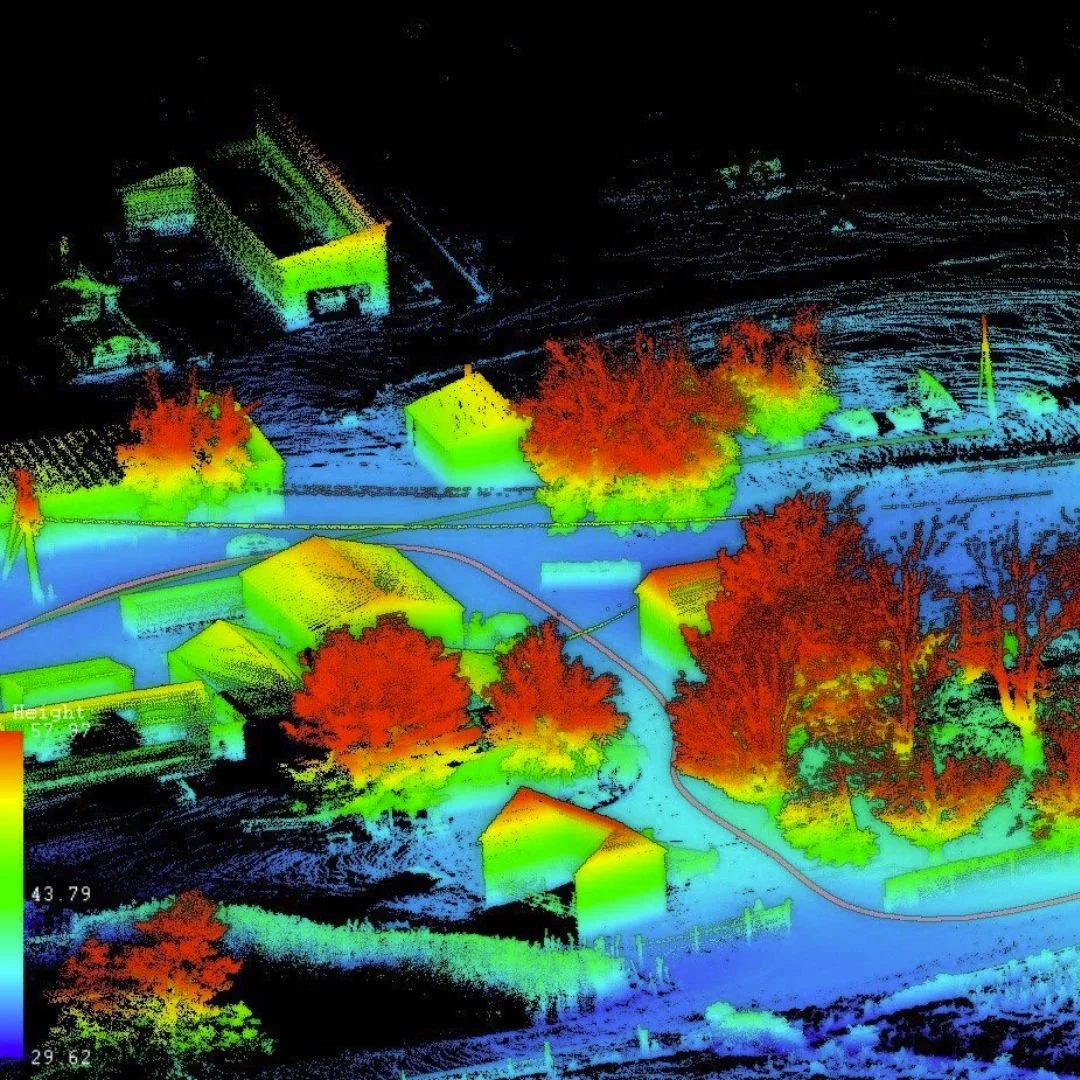
Drone mapping technology also creates orthomosaic maps and digital surface models. These detailed images help professionals analyze terrain, measure stockpiles, and evaluate site conditions.
Roof inspections represent another important service offered by the company. Drone inspections capture detailed imagery of residential and commercial roofs. This process allows inspectors to detect damage quickly while reducing safety risks.
Property owners, contractors, and insurance professionals often use these inspections to document roof conditions and plan repairs.
Veteran-Owned Expertise and Aviation Experience
Aerial Imaging Services of Maine operates as a veteran-owned business led by founder Don Williams. He brings extensive aviation experience to the company as a licensed pilot and certified drone operator.
Williams also served as a first responder for more than twenty years. His experience in incident management and emergency operations strengthens the company’s focus on safety and professionalism.
This background influences the company’s approach to every drone project. Careful planning, clear procedures, and responsible flight operations remain central priorities.
Delivering Reliable Drone Solutions Across Maine
Aerial Imaging Services of Maine continues to provide professional aerial solutions for businesses throughout the state. The company combines advanced drone technology with real-world aviation experience to deliver accurate results.
From real estate marketing to construction monitoring and roof inspections, the company provides practical aerial insights for many industries. Businesses across Maine rely on these services to improve project visibility and decision-making.
Through dependable service and modern technology, Aerial Imaging Services of Maine helps clients capture valuable perspectives from the sky.
Map
Sorry, no records were found. Please adjust your search criteria and try again.
Sorry, unable to load the Maps API.
Video
https://www.youtube.com/channel/UCLg1LfqFYbNesVqQBbYf-Ig