


Profile
Scanixx LLC
Scanixx LLC operates as a technology-driven aerial data and drone services company based in Cheyenne, Wyoming. The company focuses on collecting accurate spatial data through advanced drone mapping and aerial imaging solutions. By combining modern drone platforms with sophisticated data processing tools, Scanixx helps businesses analyze land, infrastructure, and project sites more efficiently.
The company works with industries that require precise geographic data and visual documentation. Engineers, developers, surveyors, and construction teams rely on Scanixx to capture aerial imagery and transform it into usable mapping products. These services help organizations improve planning, monitor projects, and evaluate site conditions.
Scanixx emphasizes accuracy, reliability, and efficient data delivery during every project. Each flight mission begins with careful preparation and a clearly defined data collection plan. This approach ensures that clients receive high-quality mapping results that support their operational needs.
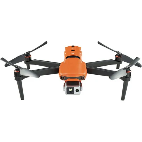
The company operates under FAA Part 107 regulations and uses certified drone pilots for commercial flight operations. These safety standards allow Scanixx to conduct aerial work responsibly across construction sites, rural landscapes, and industrial environments.
Drone Mapping and 3D Data Collection
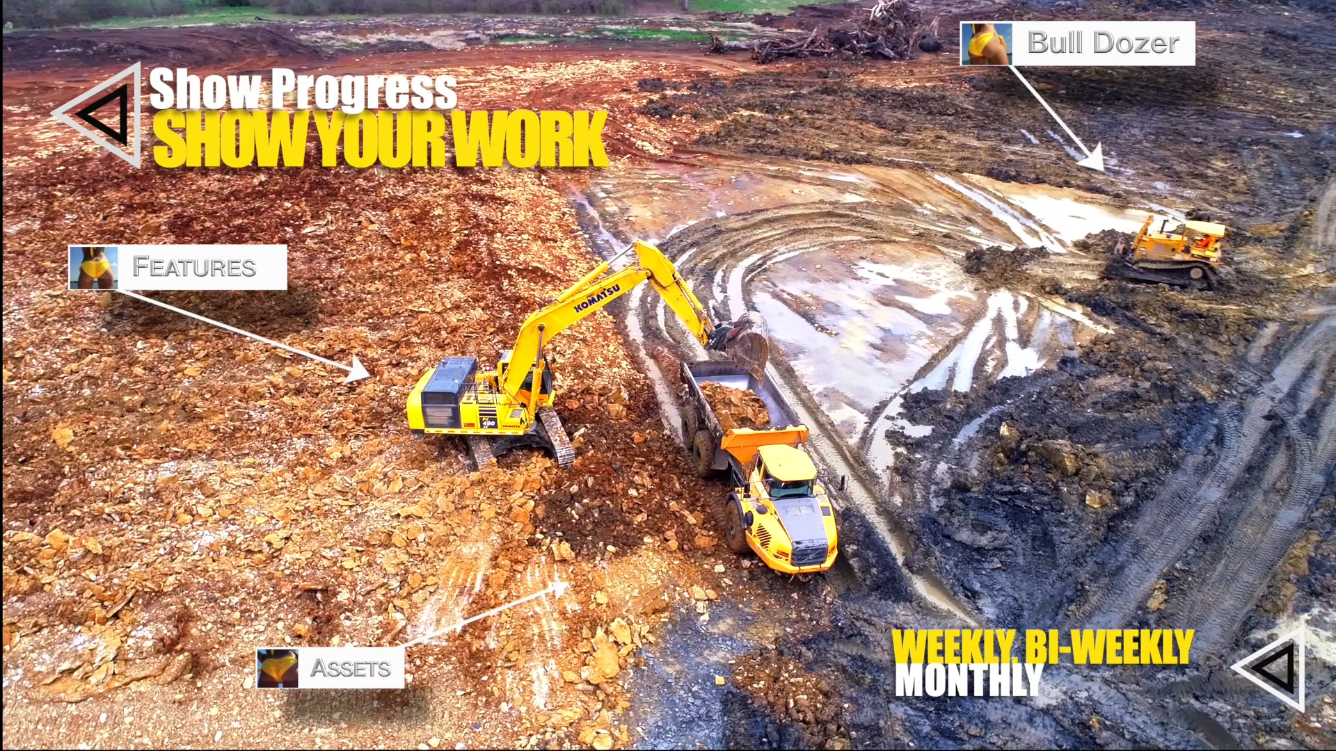
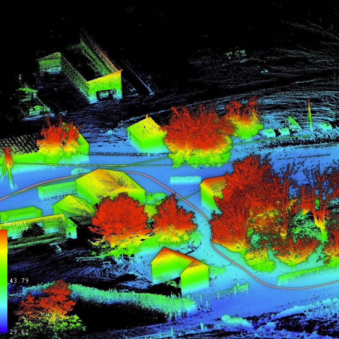
Drone mapping forms the foundation of Scanixx’s services. The company captures high-resolution aerial images that combine into detailed orthomosaic maps. These maps provide a clear and accurate overview of land features, infrastructure, and terrain conditions.
Surveyors and engineers often use this aerial data to analyze development sites. Drone mapping helps teams identify elevation changes, drainage patterns, and access routes across large areas. This information supports more informed project planning and site evaluation.
Scanixx also produces 3D models and digital terrain maps through photogrammetry techniques. These models allow professionals to measure distances, calculate volumes, and analyze complex landscapes. Project teams can review these digital models remotely, which improves collaboration and decision making.
Drone mapping also reduces the time required for traditional surveying work. Aerial data collection allows teams to cover large areas quickly while maintaining high levels of accuracy.
Infrastructure Inspections and Project Monitoring
Scanixx also provides drone inspection services for infrastructure and industrial assets. Drone platforms allow operators to capture detailed imagery of structures that are difficult to access from the ground. Inspectors can review rooftops, towers, pipelines, and other elevated structures safely.
Construction companies often rely on drone imagery to monitor building progress and site development. Regular drone flights create visual documentation that tracks how projects evolve over time. Project managers use these images to communicate progress with investors, engineers, and stakeholders.
Drone inspections also help identify maintenance issues before they become larger problems. High-resolution imagery reveals structural concerns, equipment wear, and environmental impacts.
A Technology-Focused Drone Service in Wyoming
Scanixx LLC continues to serve businesses throughout Wyoming and the surrounding region with reliable aerial data services. The company focuses on delivering accurate mapping products that support modern infrastructure development and land management.
Clients appreciate the company’s technical expertise and careful approach to data collection. Each project receives detailed planning to ensure the aerial results meet the client’s requirements.
Individuals interested in company updates and industry insights can explore the organization’s professional presence on
LinkedIn, where information about aerial technology and mapping projects often appears.
Through advanced drone platforms and data processing technology, Scanixx LLC helps organizations gather precise spatial information. The company continues to support engineers, surveyors, and developers who require accurate aerial mapping and inspection services.
Map
Sorry, no records were found. Please adjust your search criteria and try again.
Sorry, unable to load the Maps API.